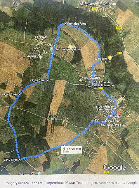
Clion-sur-Seugne 6.5km Ramble taking in Pont-des-Ânes
 |
| Photos taken on this Clion walk. |
6.5km Ramble - mainly flat. It is possible to shorten or lengthen this route quite easily by looking at Google Maps.
Largely on tarmac roads with some sections on grass through the vines and chalky tracks.
Shady stopping point by the Pont des Anes with access to the river for dogs to cool down and drink water.
Points of interest - Pont-des-Ânes (Gallo Romain Bridge), River Seugne, Old buildings in Clion including the Museum, Church, old station etc.
Start point - Parking for the Salles des Fêtes, 1 place de 19 mars 1962, Clion-sur-Seudre, 17240. (ample parking for many cars).
Once in Google Maps click on details to get the turn by turn details.
If you prefer paper maps you should use IGN Serie bleue 1533 Jonzac.


Comments
Post a Comment